If you’ve read our Ultimate Guide to GPS on Mobile Phones you’ll know that GPS isn’t all about Satellite Navigation and turn-by-turn directions. Using a Bluetooth GPS receiver with your mobile phone will open it up to a whole range of applications that will allow you to do things you may not even realise were possible on a mobile phone.
This guide will run through some of the free and paid apps for Symbian, Java, Windows & BlackBerry phones for each of the 5 types of application – Sat Nav, Tracking, Mapping, Location Aware & Geo-Tagging.
amAze GPS
Sat Nav | Free | All Phones that support Java, Windows Mobile & BlackBerry
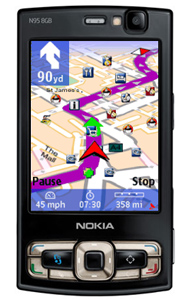
amAze GPS is probably the best free Sat Nav application available. While it’s not quite as pretty to look at, the features of this amazing free app really make up for it. It has detailed maps of Europe, North America and Australia, and unlike most applications that store all this map data on your phone, taking up valuable space, it downloads the maps as and when you need them. amAze will automatically rotate the map in the direction that you’re driving, and will even overlay your route with a satellite image of where you’re driving. Weather updates are included at no cost. If you want to reduce the amount of data being used, you can also switch to a simple mode that will just display an arrow pointing the way instead of downloading the detailed maps. Speed Camera alerts aren’t available just yet, but are coming soon. amAze GPS is easy to download and install.
The application is free, but as it relies on an internet connection and downloading very small amounts of data, we’d recommend adding an internet bundle to your account to prevent any nasty surprises on your bill.
Wayfinder Active
Sports Tracking | FREE | All Phones that support Java
Wayfinder off a range of navigation applications that are normally installed on Sony Ericsson phones and charge for their use, however Wayfinder Active is a completely free sports tracker. In a similar way to Nokia’s Tracker, you can record distance travelled, average speed, calories burnt and how long you’ve been out for. All this can then be uploaded to their website so that you can track your progress. The website also allows you to set yourself goals and then track how you’re doing against them.
Google Maps
Mapping | FREE | All Phones
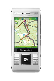
Google Maps is probably the most used mapping service on the internet, and you can now get a fully functioning version on your mobile. While it’s not quite full turn-by-turn sat nav, it can provide you with detailed instructions on how to get from A to B and can track your progress on the map. You can also use it to find nearby places and businesses as well as see traffic updates, public transport routes & online friends using Google Latitude. If you’re out and about on foot with Google Maps, Street View makes it even easier to find your way around. This video shows you more about the features in Google Maps.
We-Travel
Sat Nav | Free | All Phones that support Java, Windows Mobile & BlackBerry
Although their website isn’t quite as user friendly as some of the others listed here, as it’s a little bit technical, we-travel is one of the few free applications that stores map data on your handset. This makes navigating and route planning quite a bit quicker, although it does mean a slightly longer installation process.
Google Mobile
Location Aware | FREE | All Phones
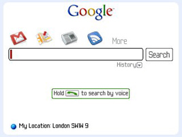
As well as allowing you to search Google without having to load your web browser, the Google Mobile application lets you search using your voice*, search nearby using your GPS position and save all your recent searches too. *Voice search is currently only available for Android, BlackBerry and iPhone.
Route66 Mobile 8
Sat Nav| From £35 | Windows Mobile & Symbian S60
Route66 is similar to use to TomTom Navigator. You can plan your routes in advance on your computer and then synchronise them with the application on your phone. You can also subscribe to traffic and weather updates at an extra cost.
TomTom Navigator 7
Sat Nav| From £55 | Windows Mobile (iPhone Coming Soon)
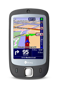
TomTom are probably the biggest name in portable navigation devices. They have the biggest user base of all sat nav systems, so this means they have the ability to add a few extra features to their mapping software. TomTom has an interface very similar to that on their portable devices, and has advanced features such as Map Share – this is where you can make corrections to the map and then share these changes with other users, as well as receive updates to your maps from others. It integrates well with your phone and will allow you to call nearby points of interest without leaving the application. TomTom Navigator 6 is available now, Navigator 7 is coming soon to Mobile Fun.
Garmin Mobile XT
Sat Nav | From £60 | Windows Mobile, Windows XP & Symbian S60
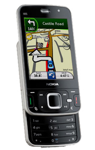
Garmin XT are another leading manufacturer of stand alone GPS units. The Mobile XT software has a few unique features – the ability to search online for photo’s of where you are, check local fuel prices and use Google local search to look for hotels, restaurants etc.
Nav4All
Sat Nav | Free | All Phones that support Java, Windows Mobile & Android
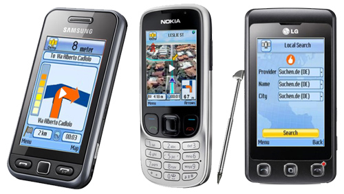
Nav4all is another universal Sat Nav application that can be used on almost any handset. Graphically it is quite basic, but it still shows you everything you need to know about your journey. It can show you a map of your journey, but navigation is done using simple arrows with distance warnings to tell you where to go. Nav4all doesn’t store the maps or points of interest on the phone, it downloads them when they’re needed, so a data allowance is recommended.
Co-Pilot Live 7
Sat Nav & Tracking | From £70 | Windows Mobile, Windows XP & Android
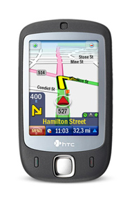
Co-Pilot works best on touch screen devices running Windows Mobile or Android, and has a separate version available if you want to be able to use it on your laptop or netbook. It gives you a choice of either 2D or 3D maps and can let you plan a journey with up to ten addresses in one trip. As with most other paid Sat Nav applications, you can subscribe to additional services such as traffic alerts, and can also be tracked live through the Co-Pilot website.
Nokia Maps
Sat Nav | From £44 | Nokia Symbian S60 & Some Symbian S40
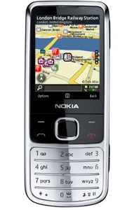
Nokia Maps is pre-installed on most Symbian S60 and S40 handsets as standard – even those without built in GPS receivers. The application itself is free to use to plan routes and search nearby for hotels, cashpoints, bars etc, but for full turn-by-turn voice navigation you will need to buy a license. Licenses can be bought on a monthly, quarterly or annual basis. The cheapest option is the 12 month license which is currently around £45.
Nokia Sports Tracker
Sports Tracking | FREE | Nokia Symbian S60 only
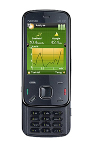
Nokia Sports tracker is a great app that can track your location, average speed, elevation as well as allow you to take (& geotag) photo’s on your way round. Once you’ve finished your workout you can upload your workout session details to the Sports Tracker website, where you can see your route on Google maps, monitor laptimes, average speed, look at your photos on a map as well as share your route with other Sports Tracker users.
eGPS Tracker
Trekking & Hiking | FREE | All Phones that support Java
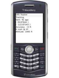
It’s a little on the basic side, but eGPSTrack will track you while you’re out and about and store the data ready to be exported to mapping software such as Google maps. You can switch between map and satellite view and export the data back to your computer to use with mapping software of your choice.
3d Tracking
Person & Vehicle Tracking | FREE | Windows Mobile & Symbian S60
3D Tracking is an application that lets you track where a person is. It can be used in one of two ways – as a real time tracker for people or vehicles, or to track where you’ve been while out running, jogging trekking etc. It integrates with Google Maps, so it’s easy to use and to see where people are/have been.
Coachr
Sports Tracking | FREE | Symbian S60, Windows Mobile – iPhone, BlackBerry (Android Coming Soon)
Formerly known as Trip Tracker Sportsmate, coachr is again similar to Wayfinder active and Nokia Sports tracker, but is completely independent of handset manufacturers and is aimed at smartphone users. As well as the standard tracking features found in the other two, coachr gives you the option of letting people follow you in real time through their website. Once your workout is complete, all the data is uploaded to their site where you can then share with friends or other site users.
InstaMapper
Person & Vehicle Tracking | FREE | Symbian S60, iPhone, Android & BlackBerry
InstaMapper is very similar to 3D Tracking, Its a web based application that uses the same Google Maps interface, but is available on a wider range of handsets. There is also a facebook application available that allows you to broadcast your location – but this could be a bit of a security risk so we wouldn’t advise you make it public to everyone!
Gypsii
Social Networking | FREE | All phones that support Java, Symbian s60, iPhone, Windows Mobile & BlackBerry
Gypsii is all about finding people and places that are near you. It can point you towards nearby places of interest based on the ratings of other Gypsii users. If you have any friends that also use the Gypsii service, it will let you know when they’re nearby so you can meet up for a chat!
Livecontacts
Social Networking | FREE TRIAL | Symbian S60
Similar to Gypsii, Livecontacts is all about sharing your location information with trusted friends. It gives you an unlimited service for 30 days, then it reduces the amount you can do unless you pay a monthly fee.
nru
Location Aware | FREE | Android
Just for Android users this one. nru has been created by lastminute.com and is an application that knows exactly where you are and which way you’re facing. It will then show you the nearest things to do and will update itself as you turn around so you can always find where you want to go. This video from lastminute.com shows the app in use.
locale
Location Aware | FREE | Android
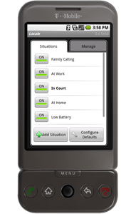
This is the clever kind of app that I love. It uses your location to adjust settings on the phone. It might seem a little confusing at first, but you can program your phone to perform certain functions when you get to predefined locations. For example – You can set the phone to remind you to charge your battery when you walk through your front door. You can set the phone to go switch to silent mode as soon as you arrive at the cinema. The list is endless and you can configure it to do exactly what you want. Shame this is only available for Android!
Trapster
Location Aware | FREE | iPhone, Symbian s60, Android & BlackBerry
This one is a must for drivers who don’t have safety camera alerts on their Sat Nav. It uses your GPS location to warn you of any upcoming safety cameras, but the thing that makes this different to other speed camera warnings, is that it’s interactive. If you are warned of a location where there isn’t a camera, give it the thumbs down, if a new one appears, a couple of presses adds it to the database and other users will be warned too. As Trapster uses an internet connection for constant updates, it can warn you of upcoming safety cameras, Mobile speed cameras, Checkpoints, places where police are waiting with hand held speed guns and places where police frequently wait with the hand held speed guns. On a serious note though, this application isn’t an excuse to speed. It is a way to help protect your license. Speeding kills, so drive safely and don’t attempt to use your phone while driving.
Locr
Geo-Tagging | FREE | Symbian S60, Windows Mobile & iPhone
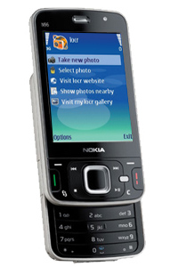
Locr is an application that can add location data to your photos in one of two ways. If you have a Symbian S60 or Windows Mobile handset, you can get the application to add the data as you take your photos. If you don’t have one of these phones, or you want to be able to tag photo’s that you take on a normal digital camera, then there is a PC/Mac application that can add GPS Data from a datalog GPS Receiver (Data Logger) to your images. Not all GPS Receivers support data logging, so you’ll need to check the spec of your receiver.
Nokia Location Tagger
Geo-Tagging | FREE | Nokia Symbian S60
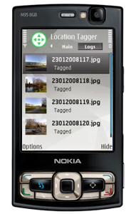
If you have a Nokia N-Series or E-Series phone and want to be able to tag your photo’s with the place they were taken, then this is the app for you. Once installed it runes alongside the camera. As soon as you turn the camera on, Nokia Location Tagger will pinpoint your location and then add your GPS coordinates to the photograph. When you upload the photo to online photo sharing sites such as flickr or picasa, you’ll be able to see where the image was taken on a map. On newer Nokia S60 devices, this feature is now built in as standard.




tauki, not quite sure what you mean. there is no charge for picking up a GPS signal – only the software that uses it. If you opt for a free application then it won’t cost you a penny.
Andy
How do we pay for the GPS? Isn’t it supposed to be free. Can it be tweaked for free?
Great list.
I would add here http://www.sportypal.com
very functional GPS mapping service, and cross platform application.
Nice list here, Andy. Some other nifty free mobile phone GPS applications worthy of note are Track My Journey, GPSviewer, Buddyway and Map my Tracks.
I have a review of them on my site. Maybe you can check it out.
http://www.javamobilecrunch.com/2009/07/free-gps-applications-for-gps-tracking.html
Regardr,
Ugo.jar
Hi Mark,
We’re trying to find out when it’s out too as we’ll be selling the car cradle that goes with it, but none of our suppliers have any news yet.
Great Guide Andy, and the Mobile Fun Team, I’m waiting on TomTom for the iPhone. They showed it off at WWDC and I still have heard nothing about when it’s coming out my very old TomTom 710 (the big bulky TomTom) is on the way out I feel!